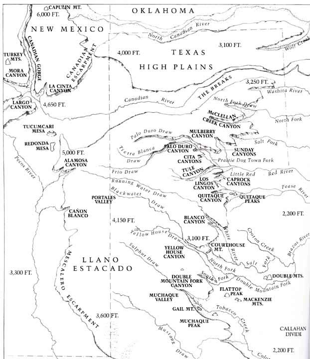
Below is a map of the canyon lands of the Texas Panhandle. The southern high
plains, known as the Llano Estacado, rises above the surrounding plains by
400' - 500'. The land falls away in great sweeping escarpments, and where the
major rivers cut through, canyons are formed creating the distinctive landscapes
of the region. Floydada would be south of Palo Duro, near Quitaque Canyon and Quitaque Peaks, on the Pease River.Click here to go back.
Map is from Caprock Canyonlands, by Dan Flores,
University of Texas Press, 1990.